Author’s Note: Many of the statements made in my paper are my opinion alone and are not approved by the BSM when delivered. This document should be considered a ”draft document” !
A study to understand the physical conditions along the shore of Lake Okeechobee from statehood to 1925 in order to better relate to the testimony and rulings of the FLORIDA SUPREME COURT, Division B, March 15, 1927 in the case of MARTIN v. BUSCH.
Martin v. Busch is important to today’s establishment of OHWL throughout Florida because it is a central case law on the methods used to establish OHWL. Martin v. Busch speaks to the use of marks on the ground or upon local objects to determine OHWL. “Marks upon the ground or upon local objects that are more or less permanent may be considered in connection with competent testimony and other evidence in determining the true line of ordinary high water mark. ” (Justice P. J Whitfield, writing/or the majority).
Relevant Facts:
At Statehood (1845), the northwestern, northern and northeastern shores of Lake Okeechobee were generally considered uplands and surveyed by the General Land Office (GLO). The southeastern, southern and southwestern shores of the lake were Swamp and Overflowed lands; the Everglades. The General Land Office (GLO) from 1853 to 1881 conducted the first Meander Line surveys on the northern (upland) shores of Lake Okeechobee.
Additional Meander Line surveys along the north side of Lake Okeechobee were conducted by the GLO from 1871-1908.
The southern shore of the Lake (the Everglades Patent) was meandered from 1914-1918 by the state surveyors under the direction of F.C. Elliott, Chief Drainage Engineer of the Everglades Drainage District (in effect, Elliott was the first State Cadastral Surveyor). The meanders of contour elevation 17 (Okeechobee Datum or O.D.) were surveyed by the State from 1926-1927.
The Everglades Drainage District was established to drain the Everglades on behalf of the trustees of the Internal Improvement Fund (Florida’s Governor and his Cabinet). The plan was to drain the Everglades for the purpose of improving the land for the use of agriculture and other private development. Once improved, the land value would be increased and the State of Florida, through the Trustees of the Internal Improvement Fund, would offer the land for sale.
One must remember that during the early days of the federal and state government, the revenue to sustain the government was primarily derived from the sale of its public lands. Generally, the feds sold the uplands and the state sold lands that it owned. In the early days, the state had title to the sovereign submerged lands of navigable waters (gained at statehood in 1845), the Swamp and Overflowed Lands (by act of Congress in 1850), and Reclaimed Lands. Reclaimed Lands are those sovereignly owned (formerly submerged lands under navigable waters) that were exposed as a result of lowering the water level of navigable water bodies. The lands between the original OHWL of the lake and the new and lower OHWL (a difference of 3.5 +/- feet by Elliott’s testimony) of the lake were considered Reclaimed Lands with the title still vested in the state by virtue of its sovereignty. The state surveyed the meanders of Lake Okeechobee after the lowering of the water level by joint federal and state approval of the drainage efforts.
The State of Florida established by survey the meander lines of the GLO and the new OHWL of Lake Okeechobee. The authority to validate all land surveys and establish the boundaries of state ownership of Sovereign Lands and Swamp and Overflowed Lands was given to the Chief Drainage Engineer of the Everglades Drainage District, Mr. F. C. Elliott. (Chapter 7892, Acts of 1919). The State of Florida’s new Meander Line of Lake Okeechobee is the Ordinary High Water Line of the lake, thereby the boundary between the sovereign and the lands within the Everglades Patent. This meander was run under state authority for the purpose of identifying, locating and establishing the true line of ordinary high water mark. (Martin v. Busch, Judge P. J Whitfield, writing for the majority, paragraph] 2).
The Swamp and Overflowed Act of Congress dated September 28, 1850, provided for the states, including Florida, to reclaim the ”Swamp Lands” within their limits. It is provided that all the
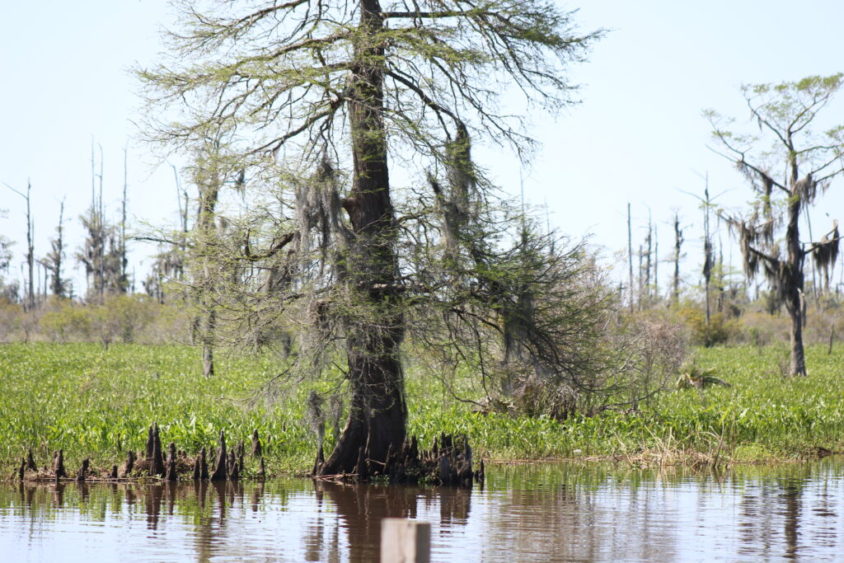
”Swamp and Overflowed Lands,” made unfit for cultivation, within the State of Florida, which remain unsold at the passage of said act, shall be granted to the state. United States Patent Number 137 (The Everglades Patent) dated April 29, 1903, conveyed The Everglades (estimated at 2,862,080 acres) to the State of Florida. Approximately one half of the shores of Lake Okeechobee were bounded by the Everglades Patent. Central to Martin v. Busch was Elliott’s testimony whereby he stated that he utilized a staff gauge mounted on a cypress tree at the mouth of the Three Mile Canal on Lake Okeechobee. This cypress tree was one of the ”marks on local objects” utilized by Elliot in determining the OHWL of the lake. He began his occasional observations at this cypress tree from 1911 and continued through the date of the Circuit Court trial (Glades County, Florida between 1924 & 1927) that ended by the appeal to the Florida Supreme Court with a ruling dated March 15, 1927. The Three Mile Canal passed through the Everglades Patent to enter Lake Okeechobee at the present location of Moore Haven, Florida. The Three Mile Canal is now a part of the Caloosahatchee Canal. It is known that the Three Mile Canal connecting Lake Okeechobee to Lake Hicpochee and an unnamed canal from Lake Hicpochee to the headwaters of the Caloosahatchee River existed in 1887. This is documented by a map entitled ”Map of Caloosahatchee River, Fla. 1887” which was surveyed in March, April and May of 1887. Said survey and map were conducted and prepared under the direction of Captain W. M. Black, of the U.S. Army Corps of Engineers, to accompany the Annual Report of 1889 (presumably for Congress). It is said ( according to the historic marker ”Lone Cypress and Everglades Drainage” located next to the Lone Cypress Tree at Lock No. 1 in Moore Haven, Florida) that in 1881, Hamilton Diston was convinced to drain the Everglades in return for half of the acreage he could reclaim. One of his early efforts was to excavate the Three Mile Canal in an effort to connect the Caloosahatchee River to Lake Okeechobee. This excavation must have occurred between 1881 and 1887 and was one of the first projects that began draining Lake Okeechobee and the Everglades. Subsequent to the connection of the Caloosahatchee River, other canals were excavated from Lake Okeechobee to the Atlantic Ocean in order to drain the Everglades. These canals were the West Palm Beach Canal, Hillsborough Canal, North New River Canal and the Miami Canal, all of which were first dug prior to 1917. The St. Lucie Canal began construction in 1916. The connection of these canals to the ocean resulted in the lowering of Lake Okeechobee. One should understanding that Lake Okeechobee fills primarily from rain, tributaries (Kissimmee River, Fisheating Creek, Taylor Creek, many other smaller unnamed creeks) and sheet flow from the prairies to the north. Knowing that, the discharge from the lake mainly was the sheet flow over the south rim of the lake and through the Everglades to the south. The Everglades terra firma is made of peat, commonly referred to as muck. The lowering of the waters of the lake exposes the south shore of the lake and the Everglades to the air and to farming. Muck exposed to air and acts of farmers first shrinks, then compacts and finally oxidizes (disappears) at an alarming rate. The first year subsides roughly a foot. Compaction plays a decreasing role but oxidation marches on at the rate of 1 inch a year until the muck is gone. If that is not enough destruction, muck will also bum. Elliott testifies (Martin v. Busch) in 1927 that the south shore of the lake has lost 3 to 4 feet in elevation from his earliest measurements in approximately 1911 as a result of such exposure. We call this subsidence!
Effects of Subsidence
Think of the south shore of Lake Okeechobee as a weir holding back the normal water levels of Lake Okeechobee. When the rainy season floods it, the lake’s water sheet flows south across the Everglades, re-hydrating the Glades and flowing toward Florida Bay.
Naturally, when the south shore subsided, the natural weir became permanently broken, thus permanently lowering the level of water in Lake Okeechobee.
The submerged land exposed below the lake’s original ordinary high water elevation of 20.4 to 20.6 feet (O.D.) and above the controlled OHWL (17.0 O.D.) is Reclaimed Bottom Lands
(Sovereign Lands) and not a part of the Swamp and Overflowed Lands (Everglades Patent). Because the federal and state governments approved the plan to lower Lake Okeechobee, the private owners of the adjacent Everglades Patent did not gain title to the Reclaimed Bottom Lands by the doctrine of reliction (Martin v. Busch, Judge P. J. Whitfield, writing for the majority).
The new meander line surveyed by the state was contour elevation 17.0 (O.D.). This is evident from several supplemental township plats on the northern shore of the lake as well as the township plats for the Everglades Patent on the southern shore of the Lake. This fact is also demonstrated by
”Memorandum A” described below.
“Memorandum A”, written by F.C. Elliott (October 25, 1927) to accompany the letter from Hon. John W. Martin, Gov. to Hon. Frank R. Reid, Member of Congress, Chairman of Committee on Flood Control. This letter asked for federal assistance in the cost of improving the Caloosahatchee River downstream of Ft. Thompson for the purpose of navigation. The state acknowledges responsibility for managing Flood and Drainage Control elements within the lake and St. Lucie and Caloosahatchee Canals and the Everglades Drainage District, however clearly does not accept responsibility for any improvements that would go beyond flood/drainage to assist navigation. Projects to improve navigation are the responsibility of the federal government. The state suggested that it is willing to share in the cost of common projects to the extent that the state would not pay for the cost of improvements associated with navigation. The state’s option was to discharge the lake water
through the St. Lucie Canal and the other aforementioned canals, not the Caloosahatchee, which was not cost effective to improve without the aid of federal monies.
Many details are described in this Memorandum. Pages 5 and 6 speak directly to managing the water elevations of the Lake Okeechobee between the elevations of 17.0 and 14.0 (O.D.). The higher elevation was considered the highest lake level safely managed by levees, etc. and the lower elevation being the lowest level of the lake to accommodate navigation.
Memorandum A is evidence as to why the limits of the sovereign (ordinary high water line) were ultimately determined to be elevation 17.0 (O.D.) and why the state considered it the new OHWL and why the state meandered the lake along that contour. Due to the date of the report, and its explicit mention of the elevation datum being “M.L.W., Gulf of Mexico, Punta Rasa, to which datum elevations on and about the lake are referred” (page 3) it is obvious that they are referring to the datum we now know as “Okeechobee Datum”. Another interesting and revealing source of information regarding the drainage of Lake Okeechobee was written by John Kunkel Small. Narrative of a Cruise to Lake Okeechobee, by John Kunkel Small, the Head Curator of the Museums and Herbarium of the New York Botanical Gardens. Small commenced his second botanical exploration of southern Florida on May 5, 1917. Small writes of his first exploration:
“When cruising in Okeechobee in 1913 we spent an afternoon and a bright moonlight night in Pelican Lake (Bay). Then it was filled with floating Islands of the water hyacinth and water lettuce. It was surrounded by beautiful pond apple hammocks which were fringed with a growth of water hyacinth and water lettuce made up of plants more robust and larger than had previously been recorded. The hammock islands served as immense heron rookeries and the waters abounded in alligators of all sizes. Today (1917) it is a waste. The lowering of the waters of Okeechobee has changed these conditions and, instead of the paradise described, the exposed bottom of the lake as far as the eye could see support a dense growth of large pigweed “careless” (Acnida). The site was dishearting.” (From article in the American Museum Journal, Vol. 18, 1919.)
Note: The Small article does not document the elevation of the lake at the time of his trip. He does say that the water “was exceptionally low owing to the prolonged drought”. John Kunkel Small took many of the historic photos we now have of Lake Okeechobee and the region.
I have studied seven locations around the shores of Lake Okeechobee in anticipation of field exploration to see first hand evidence that may still remain from the era of the Martin v. Busch rulings. These specific study areas have utilized digital aerial photography, the survey records of GCY, Inc., Professional Surveyors and Mappers, other local surveyor’s records and the Public Records of the SFWMD and FDOT. Four of the seven fall within the limits of the Everglades Patent. The field review of the assembled data will allow further understanding of the conditions that existed from the time of statehood (1845) to current times.